During the week of July 26th – 30th, fieldwork in the Passeier Valley was conducted with the main goal of data collection. The collected information corresponds to soil samples and the execution of the Dynamic Cone Penetration Test (DCPT). Laboratory analysis will be carried out from the collected data to classify the soil material and extract hydrological and geotechnical parameters such as soil density, water content, hydraulic conductivity, cohesion, and friction angle, which are essential inputs for the physically-based modeling.
The fieldwork in the five days was mainly divided into two stages. The first one consisted of digging a soil pit (with dimensions of 1m x 1m x 1m) at each previously selected location to have a clean soil profile for descriptions and sampling. Out of the soil profile, two buckets of material and several ring-shaped samples for laboratory analysis were taken at different depths to have a suitable representation of the soil profile. Furthermore, the second stage involved the execution of the DCPT to determine the soil depth and have a general overview of the soil structure. All the sampling and tests were done after discussing and getting permission from the landowners.
Lastly, the fieldwork team was very grateful for the friendliness of the farmers in the Passeier valley. The conversations with them gave great detail of information on the local problems with landslides and of course, their corporation in allowing the samples to be taken from their fields, was also very thankful.
-
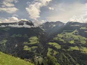
- East flank of the Passeier valley. Taken from the surroundings of Vernurio.
-
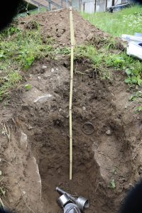
- Example of sampled and described soil profile.
-
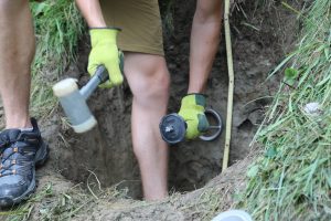
- Collection of soil in the rings for laboratory analysis.